Towns and Cities
Keeping Citizens Happy with Transparent Services: A Primer
'Government' conjures images of busy hold times and delayed responses. How can your local government break the mold?
GPRS Inc. had mastered utility location finding risks below ground. Now looking to deliver premier service in the cloud, they partnered with Spatial DNA.
Construction is a risky business.
In 2018 alone, the industry saw $30 billion in damages, a utility strike every 60 seconds, over 2,000 injuries and over 400 deaths, according to GPRS. To avoid this, before the first brick is laid, site managers need to know their foundations are being laid on solid — and safe — ground.
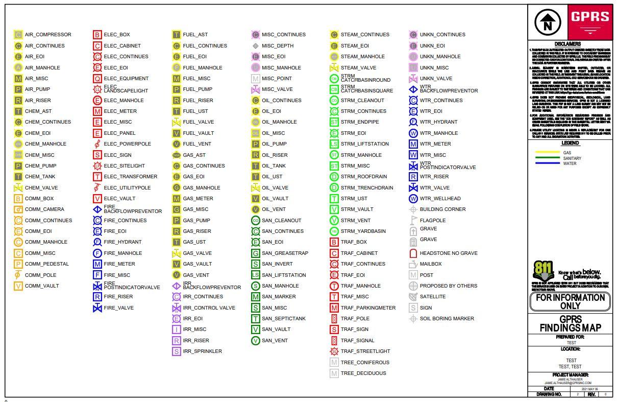
Founded in 2001, utility location group Ground Penetrating Radar Services Inc. has been tackling this problem by focusing solely on perfecting the science of utility location and subsurface scanning. With offices nationwide covering utilities, underground, the outdoors, GPRS has an accuracy rate of over 99.8% on 72,000 concrete scanning and utility locating projects, helping clients avoid damages, delays and injuries.
Rapidly growing in size as a company and having top-tier ground level utility location services, GPRS turned their sights to innovating their cloud technology to serve their clients better, and free their staff’s time.
The Problem
GPRS customers would often request maps showing the results of scans. Generating easily readable maps involved manually collecting data from sources and having the team’s experts create them and email them to clients.
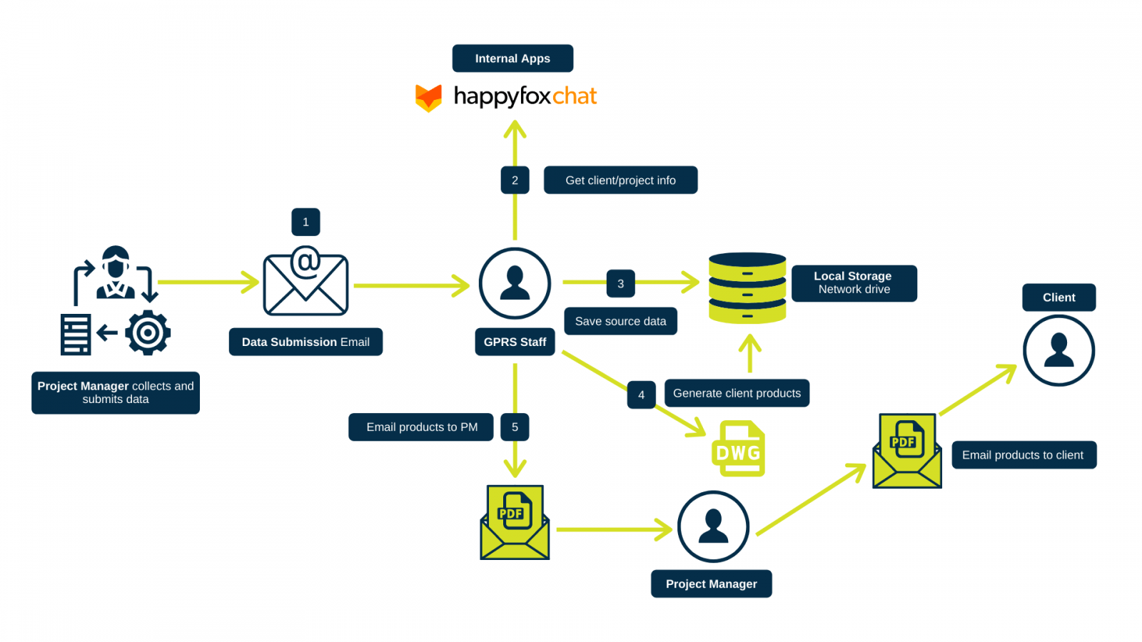
Diagram showing GPRS map creation process flow
“Customers let you know pretty quickly when your service has gaps or could be improved,” explained Todd Lewis, CEO of Spatial DNA. “GPRS aggressively searched for a solution to incorporate their customers’ feedback into their product offering that differentiated their service. Automating map delivery to all customers was the way to over-deliver on their services.”
An engineer at the company who was researching solutions found FME as a potential solution, and Spatial DNA as a recommended partner on the Safe Software website.
The Solution
Over nine months, Spatial DNA worked with GPRS to implement an FME cloud based automation to allow the GPRS team to view their data, to support the creation of high quality PDF maps for clients, as well as submission letters, emails and attachments and links to collected data. All within minutes.
“[The task] was not easy,” explained Jamie Althauser, Field Director at GPRS. “We have a bunch of historical data that was not standardized and formatted the same way so they automated a process to convert all that.”
“A big part of it was their expertise and understanding database structure and how to get all that data formatted, and then automating that process, and then creating a map from that. There were a lot of steps and it was not easy.”
The team worked closely with Spatial DNA’s data experts before and after launch, both in design — informing them exactly how utility location fieldwork operated and what the final solution should look like.
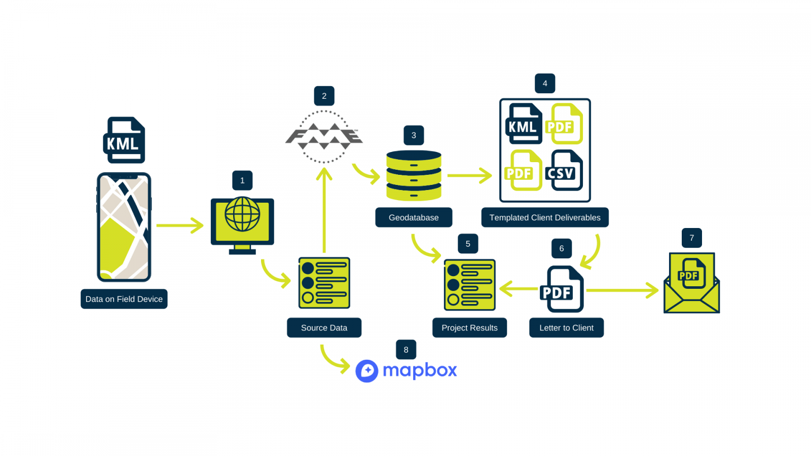
Today, the process of gathering, collating, manually decoding, translating and sending maps to clients has been automated into a few simple steps, which happen in a matter of minutes.
The Result
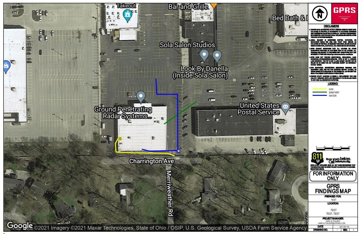
Today, generated maps not only can be emailed to clients but data from sites is stored on GPRS’ database, giving them unparalleled insight into subsurface mapping and analytics — and the ability to visualize and share it.
Post-launch, the team has stayed in touch to ensure any initial issues are resolved, and that the company is fully equipped to manage the software.
“It’s been going great,” says Althauser. “There are hiccups. That’s a good word for them. Because there’s not been any major problems, just little hiccups and bugs, which, you know, which happens with any new system like that. And Spatial DNA has been very responsive, able to fix everything quickly when anything happens.
“We couldn’t have done it ourselves. So we really appreciate Spatial DNA’s help,” said Althauser. “They have more than just knowledge of the FME software, but they did a good job of understanding our business and what we were trying to accomplish, and then knowledge of mapping and the look and feel from the marketing side of what we were trying to accomplish for the client.”
“They really do deliver in a lot of different ways and it was great working with them,” said Althauser.
“This project with GPRS is a great example of automating a highly manual workflow. The GPRS team knew exactly what they wanted as an outcome. They were very detailed in their reviews, which really helped us deliver quickly. We’re looking forward to working with GPRS in the future,” said Lewis.
Want to learn about how you can integrate the power of FME into your company? Contact us at https://spatialdna.com/.
'Government' conjures images of busy hold times and delayed responses. How can your local government break the mold?
A good digital transformation strategy allows for safe and efficient data management, and — equally important — liberation.
You'd be surprised at how little functionality some APIs provide: can they actually connect your two systems? Here's what to look for in a vendor's...